See below the ground with GeoDin Ground Civil 3D app
GeoDin Ground is an app developed by GeoDin and Autodesk for civil and design engineers to see below the ground in Civil 3D.
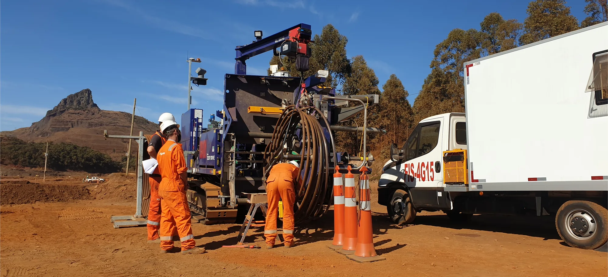
.png)
Bridge the gap from ground truth to design reality
GeoDin Ground is a comprehensive solution offered to tackle the challenges faced by design teams and geotechnical engineers. This results in safer and cost-efficient designs, contributing to a safe and livable world.
How does GeoDin Ground benefit civil and design engineers?
Enhance design accuracy
GeoDin Ground empowers you to see beneath the surface directly within Civil 3D. By integrating comprehensive ground data, you can create truly optimized designs, perfectly tailored to the specific conditions of your site, eliminating guesswork and ensuring a solid foundation from the start.
Collect and store everything in one place
Our software securely manages all types of borehole data with flexible import options from any format (Excel, CSV, databases, and more), ensuring your project
Improve collaboration
GeoDin Ground enhances team communication by providing a clear, shared view of subsurface conditions within Civil 3D. This improved understanding fosters better collaboration between design and geotechnical teams, allowing for proactive identification and mitigation
Visualize your ground data in detail
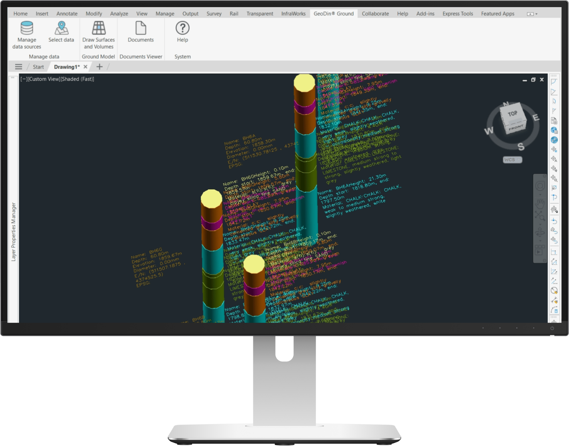
Boreholes directly visible in Civil 3D
Visualize your boreholes directly in Civil 3D. Clay, sand, dirt? With color coded lithological layer descriptions, it's easier to understand what the sampled boreholes are made of.
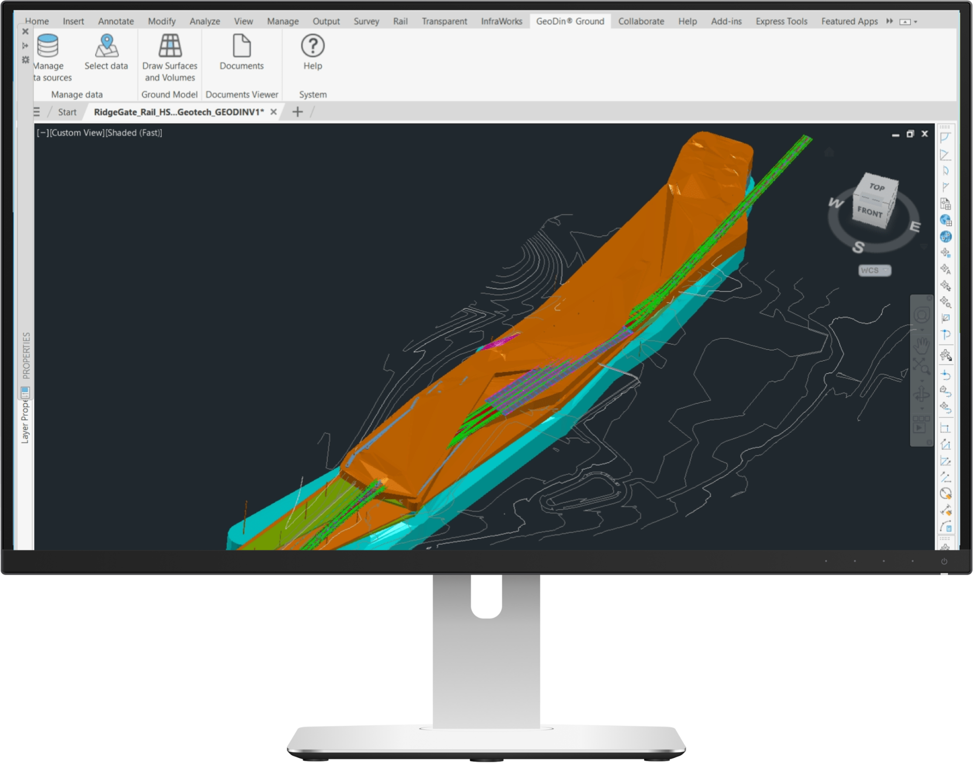
Adjustable surfaces and volumes
Drawing surfaces and volumes between your boreholes was never this easy. Trying to understand how the surfaces interact with each other? Turn the desired layers on and off to better visualize specific surfaces or to see the exact volumes.
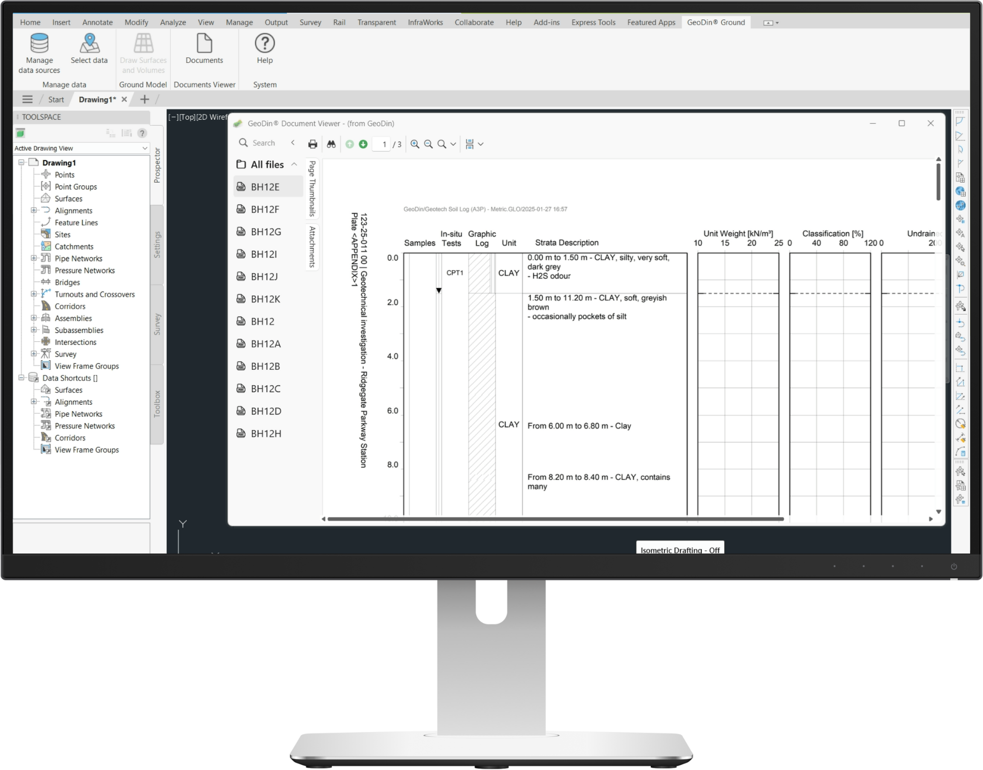
Relevant documents attached to boreholes
Do you have to visualize the technical representation of your borehole? GeoDin Ground has an integrated document viewer that helps you pull up the technical documentation to better understand your ground data.
Let’s take a step back: why is this integration of ground data in the design phase so important?
From data silos to seamless collaboration
Design engineers often face the challenge of designing structures without a complete understanding of the underlying ground conditions. This lack of knowledge can lead to costly mistakes and project delays. Two teams are mainly affected by this: designers and geotechnical engineers. More specifically, the information exchange between the two is hindered by the:
- Import & extraction of data
- Validation and geo-alignment
- Data cleaning & interpretation
- Determining the sufficiency of data
Earlier ground visibility and having a single source of geodata can make a significant change.
One source, endless possibilities
Traditional methods of incorporating ground data into designs relied a lot on using separate sources of data and file types. GeoDin offers you the possibility of having a single source of truth for your geodata. With GeoDin Ground, you are able to directly access this data in Civil 3D. This allows you to create designs that are safe, efficient, effective and maximize sustainability, as the risk for overengineering is limited.
Various types of geodata visible in Civil 3D
We can understand that you’re curious to learn what ground data is displayed in Civil 3D with GeoDin Ground. In short, it’s:
- Borehole information
- Standard-compliant lithological layer descriptions
- Sample data
- Data obtained from methods such as CPT investigations
- 50+ classification and advanced geotechnical tests

Why geotechnical engineers love GeoDin Ground
For geotechnical engineers, GeoDin Ground is a great relief. Their work, an advanced overview of the ground conditions, can now be viewed in all its glory, directly in Civil 3D. It results in a stronger and more efficient workflow amongst building and construction teams.
Why civil engineers and designers love GeoDin Ground
Designers are now able to see below the ground in their design environment, instead of having to tend to multiple different sources of data to design a solid foundation. This leads to huge time and cost savings, to greater sustainability in building and to reduced risks.
The GeoDin Ground app for Civil 3D allows you to integrate ground data in your designs, enabling you to create perfect designs that are fully tailored to the ground it stands on.
Frequently Asked Questions
If you don’t see your question here, we’re always available to help.
Get in touch to discuss your needs, explore opportunities, or clarify how we work.
Contact us