Geotechnical solutions to help build on Solid Ground
Anything that is built needs to have a solid foundation. Not having clear insight into the ground conditions leads to unsafe and costly situations. GeoDin offers various tools to help you visualize the ground, from geodata capturing to management in a central enterprise geodatabase and visualization, both in our own software as well as design software like Civil 3D.

Meet GeoDin Suite, your comprehensive solution for geotechnical engineering.
This suite brings together specialized tools:
- GeoDin for standards-compliant data management, geodatabase creation and visualisation of geodata
- GeoDin Ground for enhanced Civil 3D integration
- GeoDin Onsite for streamlined site data capture
From capturing data directly from the investigation site to storing the borehole locations and measurements to later on visualize the numerical data, GeoDin Suite is supporting the entire geotechnical workflow from A to Z.
From small to large size companies, GeoDin Suite’s geotechnical software solutions are meant to any company that wishes to build on Solid Ground.
How GeoDin Suite works - in 3 steps
An advanced collection of specialized tools designed to support every aspect of your geotechnical workflows.
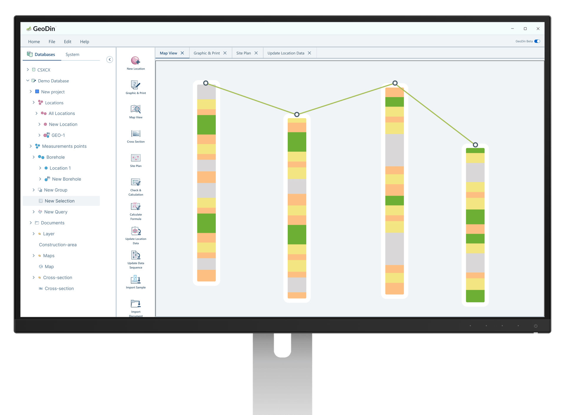
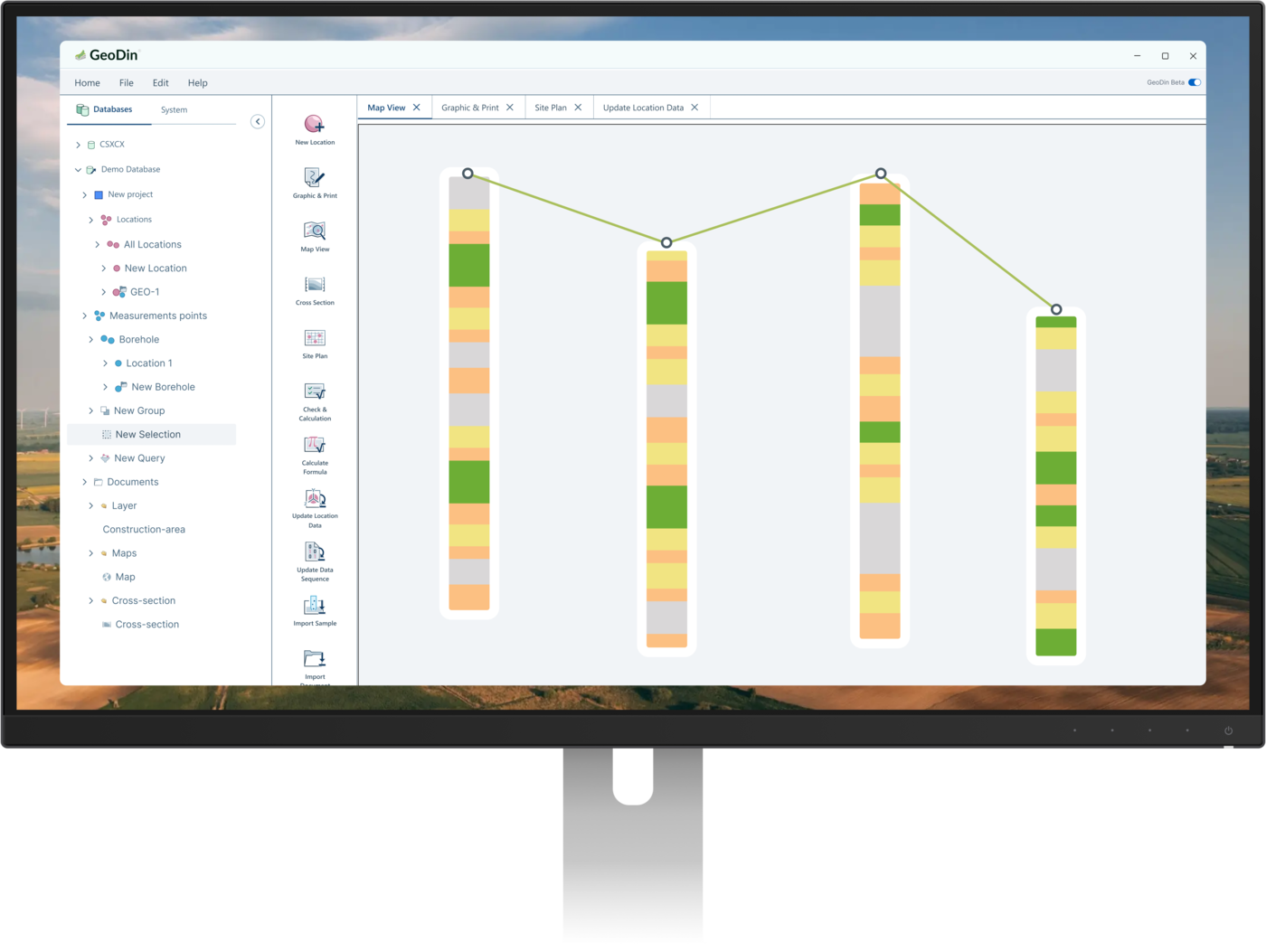
GeoDin - storing, managing and analyzing geotechnical data
Any strong foundation relies solely on data.
However, huge quantities of data can be overwhelming to store, manage and analyze. GeoDin, our flagship product, is the number 1 geodatabase software that enables you to create robust geodatabases to visualize what’s beneath the ground.
GeoDin is addressing the diverse needs of geotechnical engineers, striving to support you through every step of your workflow.
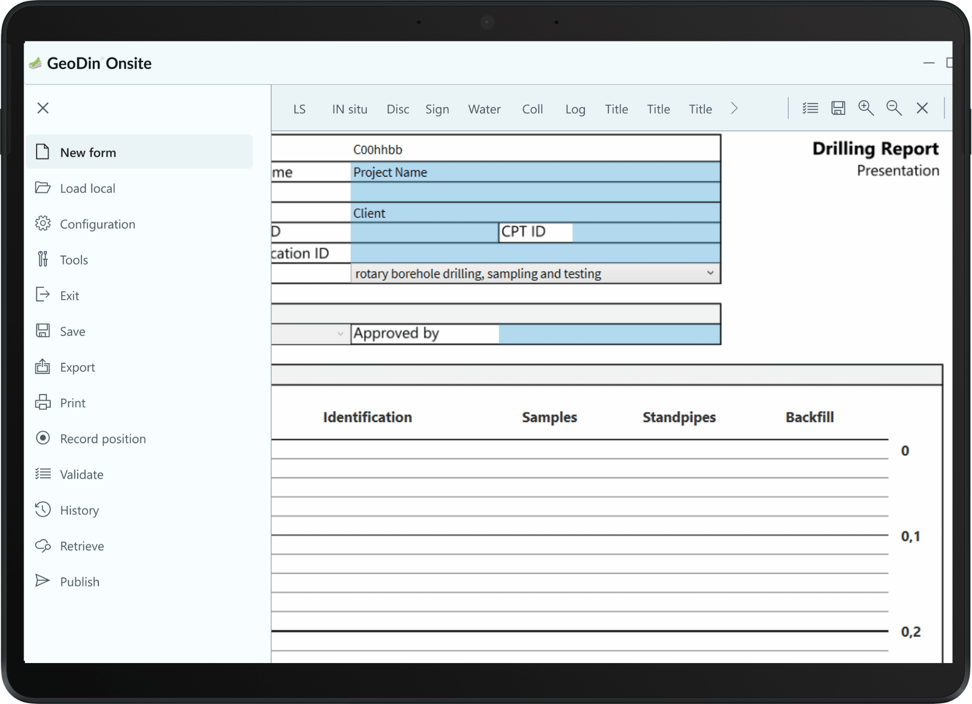
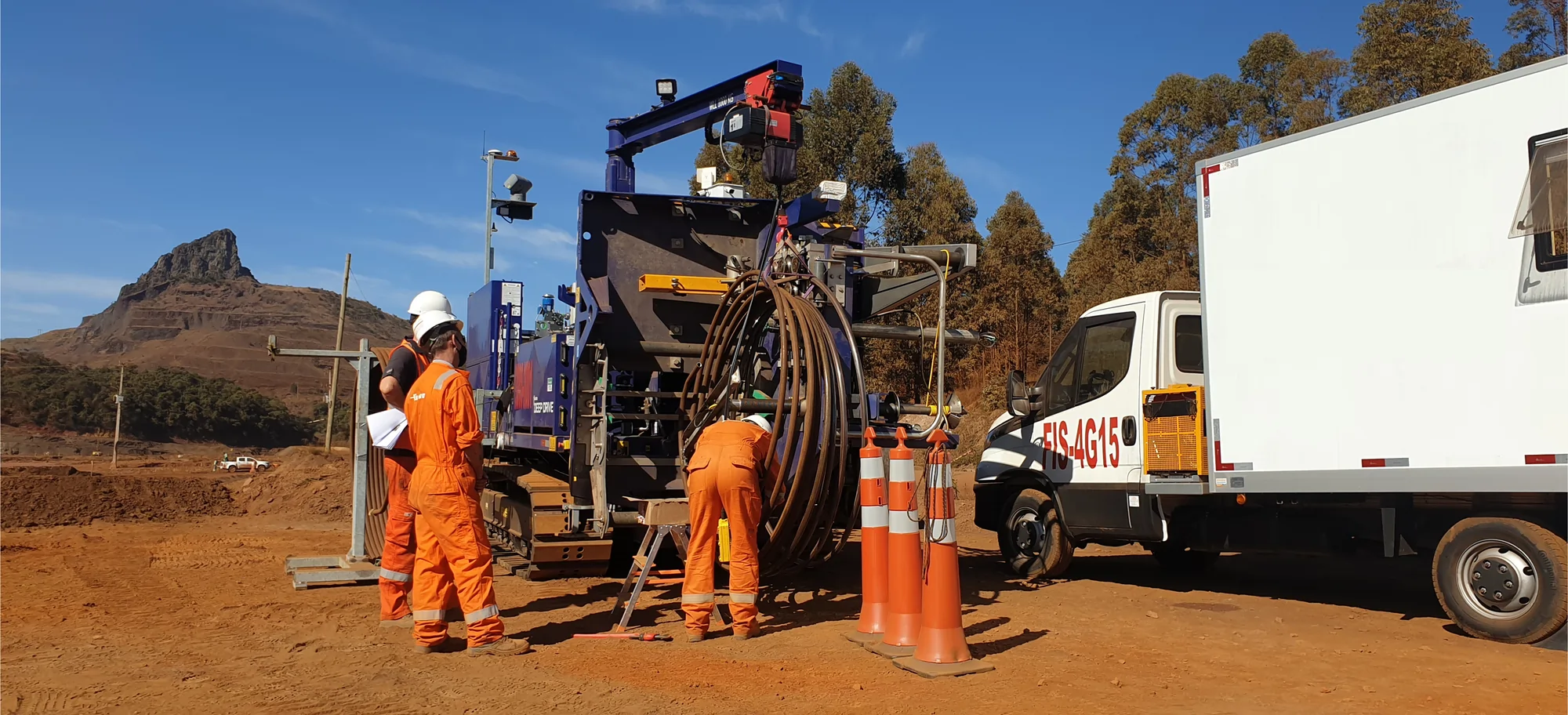
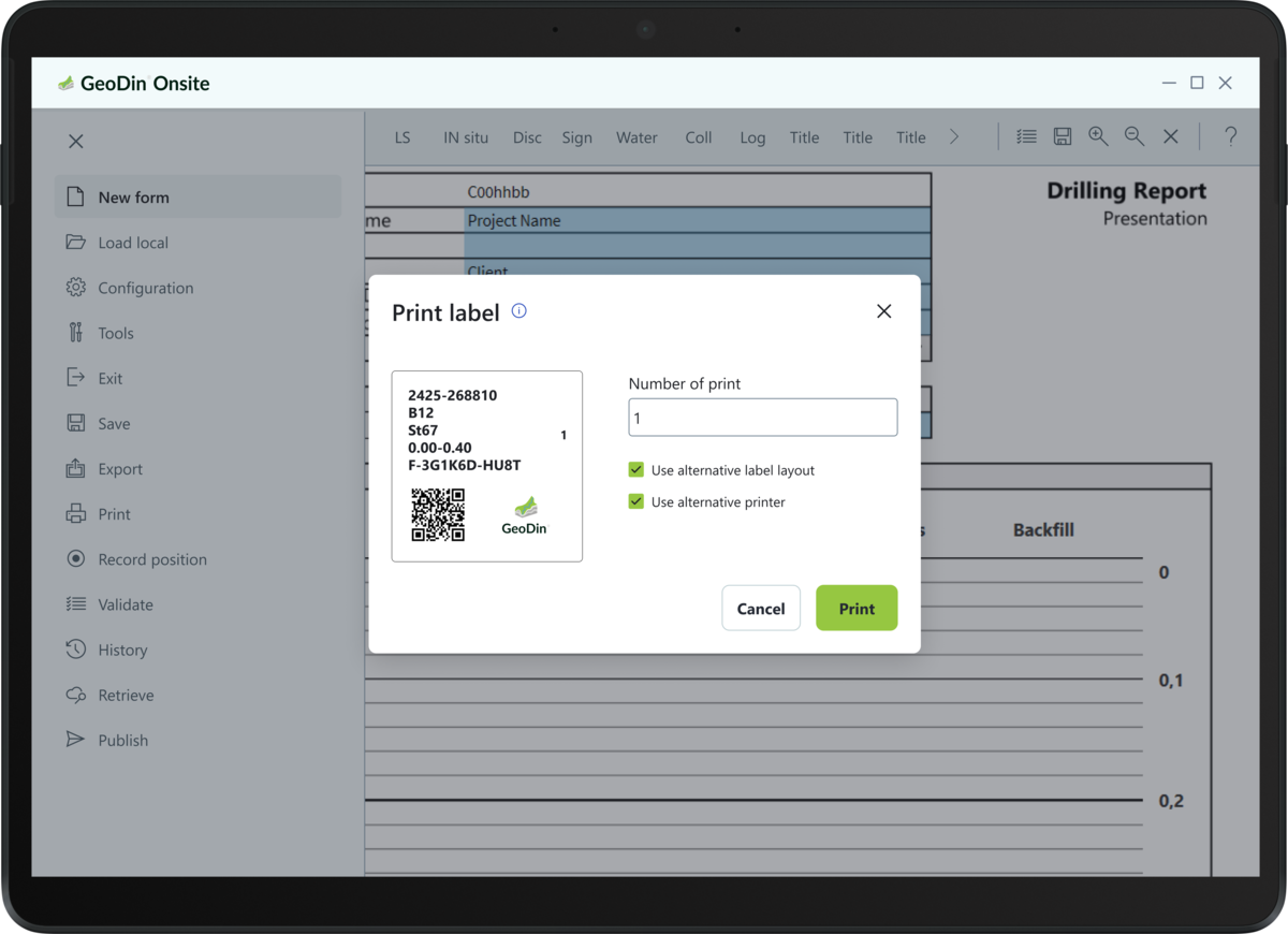
GeoDin Onsite - capturing raw geodata with direct storing into the geodatabase software
Capturing data from the site just became easier. The often-rough conditions from site investigations can slow down the capturing and labelling of data. With GeoDin Onsite you can capture the data digitally and print labels on the spot, never losing another sample.
GeoDin Ground – see the ground visualized in Autodesk Civil 3D
Visualizing the geotechnical data is equally important as storing and capturing it. Geotechnical engineers often struggle with translating/transforming the data into a geotechnical model that is fundamental for building on a strong foundation. GeoDin Ground is a Civil 3D app that enables geotechnical engineers to visualize what’s beneath the ground.
When the design process starts, designers need to know the conditions of the ground. Integrating ground data in designs was hard. But no more, since GeoDin Ground easily visualizes ground data directly in Civil 3D, allowing designers to see the ground as they are designing.
GeoDin is committed to build an enterprise geodatabase that offers the best geotechnical software solutions designed and thought of by fellow geotechnical engineers.